7. Tabriz Historic Bazaar Complex, Iran.
Tabriz has been a place of cultural exchange since antiquity and its historic bazaar complex is one of the most important commercial centres on the Silk Road. Tabriz Historic Bazaar Complex consists of a series of interconnected, covered, brick structures, buildings, and enclosed spaces for different functions. Tabriz and its Bazaar were already prosperous and famous in the 13th century, when the town, in the province of Eastern Azerbaijan, became the capital city of the Safavid kingdom. The city lost its status as capital in the 16th century, but remained important as a commercial hub until the end of the 18th century, with the expansion of Ottoman power. It is one of the most complete examples of the traditional commercial and cultural system of Iran.

8. Bikini Atoll, Marshall Islands.
In the wake of World War II, in a move closely related to the beginnings of the Cold War, the United States of America decided to resume nuclear testing in the Pacific Ocean, on Bikini Atoll in the Marshall archipelago. After the displacement of the local inhabitants, 67 nuclear tests were carried out from 1946 to 1958, including the explosion of the first H-bomb (1952). Bikini Atoll has conserved direct tangible evidence that is highly significant in conveying the power of the nuclear tests, i.e. the sunken ships sent to the bottom of the lagoon by the tests in 1946 and the gigantic Bravo crater. Equivalent to 7,000 times the force of the Hiroshima bomb, the tests had major consequences on the geology and natural environment of Bikini Atoll and on the health of those who were exposed to radiation. Through its history, the atoll symbolises the dawn of the nuclear age, despite its paradoxical image of peace and of earthly paradise. This is the first site from the Marshall Islands to be inscribed on the World Heritage List.

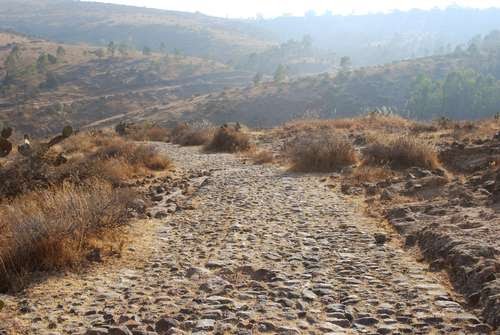
9. Camino Real de Tierra Adentro, Mexico.
Camino Real de Tierra Adentro was the Royal Inland Road, also known as the Silver Route. The inscribed property consists of 55 sites and five existing World Heritage sites lying along a 1400 km section of this 2600 km route, that extends north from Mexico City to Texas and New Mexico, United States of America. The route was actively used as a trade route for 300 years, from the mid-16th to the 19th centuries, mainly for transporting silver extracted from the mines of Zacatecas, Guanajuato and San Luis Potosí, and mercury imported from Europe. Although it is a route that was motivated and consolidated by the mining industry, it also fostered the creation of social, cultural and religious links in particular between Spanish and Amerindian cultures.
10. Prehistoric Caves of Yagul and Mitla in the Central Valley of Oaxaca, Mexico.
This property lies on the northern slopes of the Tlacolula valley in subtropical central Oaxaca and consists of two pre-Hispanic archaeological complexes and a series of pre-historic caves and rock shelters. Some of these shelters provide archaeological and rock-art evidence for the progress of nomadic hunter-gathers to incipient farmers. Ten thousand-year-old Cucurbitaceae seeds in one cave, Guilá Naquitz, are considered to be the earliest known evidence of domesticated plants in the continent, while corn cob fragments from the same cave are said to be the earliest documented evidence for the domestication of maize. The cultural landscape of the Prehistoric Caves of Yagul and Mitla demonstrates the link between man and nature that gave origin to the domestication of plants in North America, thus allowing the rise of Mesoamerican civilizations.

11. Seventeenth-century canal ring area of Amsterdam inside the Singelgracht, Netherlands.
The historic urban ensemble of the canal district of Amsterdam was a project for a new ‘port city’ built at the end of the 16th and beginning of the 17th centuries. It comprises a network of canals to the west and south of the historic old town and the medieval port that encircled the old town and was accompanied by the repositioning inland of the city’s fortified boundaries, the Singelgracht. This was a long-term programme that involved extending the city by draining the swampland, using a system of canals in concentric arcs and filling in the intermediate spaces. These spaces allowed the development of a homogeneous urban ensemble including gabled houses and numerous monuments. This urban extension was the largest and most homogeneous of its time. It was a model of large-scale town planning, and served as a reference throughout the world until the 19th century.

12. Historic Villages of Korea: Hahoe and Yangdong, Korea.
Founded in the 14th-15th centuries, Hahoe and Yangdong are seen as the two most representative historic clan villages in the Republic of Korea. Their layout and location - sheltered by forested mountains and facing out onto a river and open agricultural fields – reflect the distinctive aristocratic Confucian culture of the early part of the Joseon Dynasty (1392-1910). The villages were located to provide both physical and spiritual nourishment from their surrounding landscapes. They include residences of the head families, together with substantial timber framed houses of other clan members, also pavilions, study halls, Confucian academies for learning, and clusters of one story mud-walled, thatched-roofed houses, formerly for commoners. The landscapes of mountains, trees and water around the village, framed in views from pavilions and retreats, were celebrated for their beauty by 17th and 18th century poets.

13. At-Turaif District in ad-Dir'iyah, Saudi Arabia.
This property was the first capital of the Saudi Dynasty, in the heart of the Arabian Penisula, north-west of Riyadh. Founded in the 15th century, it bears witness to the Najdi architectural style, which is specific to the centre of the Arabian peninsula. In the 18th and early 19th century, its political and religious role increased, and the citadel at at-Turaif became the centre of the temporal power of the House of Saud and the spread of the Wahhabi reform inside the Muslim religion. The property includes the remains of many palaces and an urban ensemble built on the edge of the ad-Dir’iyah oasis.

14. Proto-urban site of Sarazm, Tajikistan.
Sarazm, which means “where the land begins”, is an archaeological site bearing testimony to the development of human settlements in Central Asia, from the 4th millennium BCE to the end of the 3rd millennium BCE. The ruins demonstrate the early development of proto-urbanization in this region. This centre of settlement, one of the oldest in Central Asia, is situated between a mountainous region suitable for cattle rearing by nomadic pastoralists, and a large valley conducive to the development of agriculture and irrigation by the first settled populations in the region. Sarazm also demonstrates the existence of commercial and cultural exchanges and trade relations with peoples over an extensive geographical area, extending from the steppes of Central Asia and Turkmenistan, to the Iranian plateau, the Indus valley and as far as the Indian Ocean.

15. Central Sector of the Imperial Citadel of Thang Long - Hanoi, Viet Nam.
The Thang Long Imperial Citadel was built in the 11th century by the Ly Viet Dynasty, marking the independence of the Dai Viet. It was constructed on the remains of a Chinese fortress dating from the 7th century, on drained land reclaimed from the Red River Delta in Hanoi. It was the centre of regional political power for almost 13 centuries without interruption. The Imperial Citadel buildings and the remains in the 18 Hoang Dieu Archaeological Site reflect a unique South-East Asian culture specific to the lower Red River Valley, at the crossroads between influences coming from China in the north and the ancient Kingdom of Champa in the south.

No comments:
Post a Comment